Commercial Aerial Cinematography
Cinema-grade aerial footage engineered for brands, real estate developments, and commercial showcases.
- 4K cinema capture
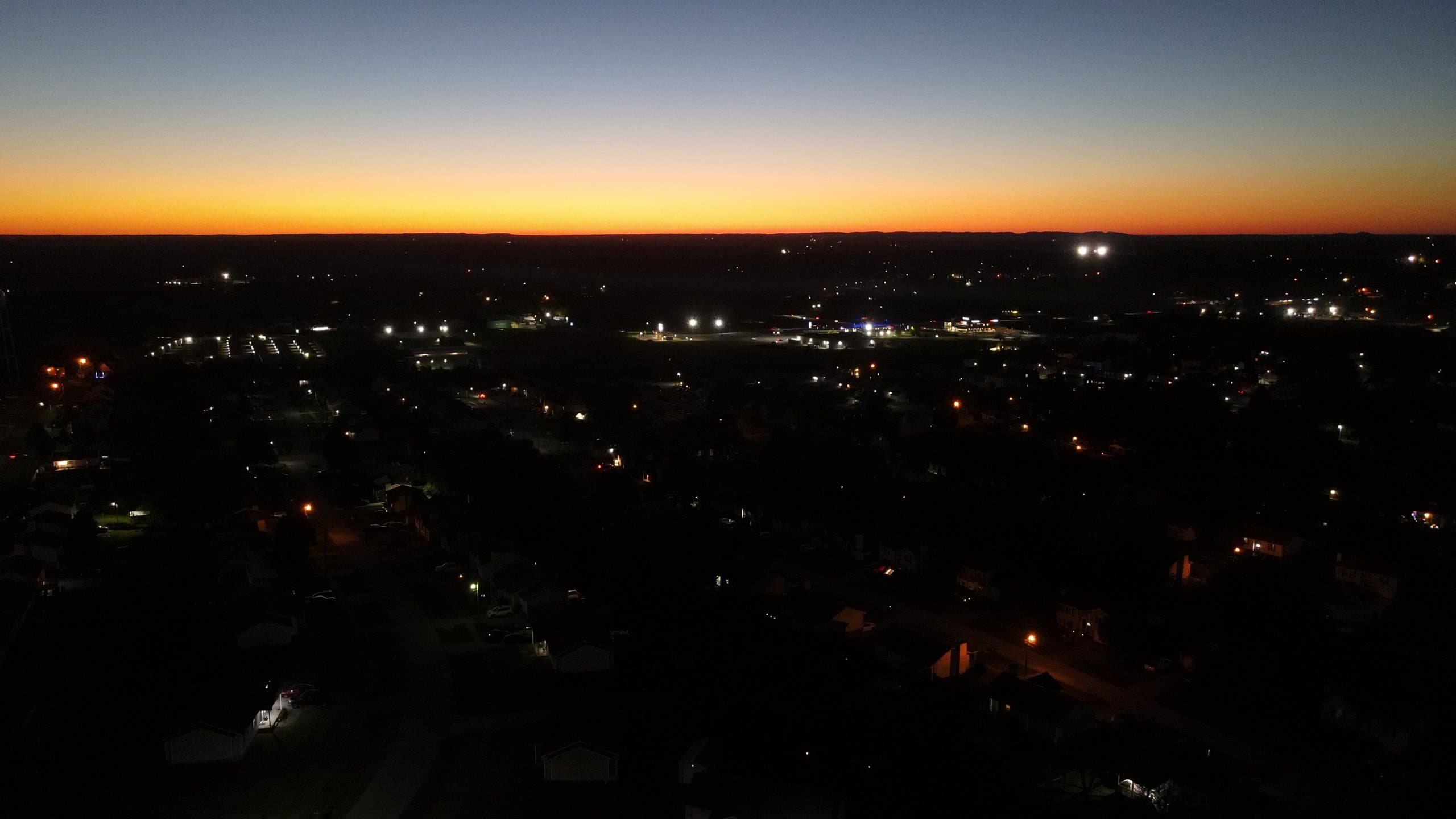
- Civil twilight & golden hour
- Licensed FAA Part 107 flight
 FAA Part 107 Certified • Precision Engineering
Aerolens Media LLC delivers turnkey capture and fabrication from a single certified team — high-resolution drone inspections, cinema-grade aerial video, and functional multi-material 3D prototypes, delivered on schedule.
Services
Certified flight operations and engineering-grade fabrication, scoped and delivered under one contract.
Cinema-grade aerial footage engineered for brands, real estate developments, and commercial showcases.
Data-rich, high-resolution visual inspections that reduce risk and eliminate ladder setup.
Precision reality capture and multi-material engineering fabrication from broken part to final component.
3D Printing & Rapid Prototyping
High-speed engineering
High-speed CoreXY with a hardened all-metal hotend for carbon-fiber reinforced nylon, high-temp engineering filaments, and rapid-turnaround prototypes.
Large format
Large-format continuous build volume for oversized functional enclosures, architectural mockups, and batch production runs.
Utility & tooling
Dedicated custom utility platform for rapid tooling, PLA/PETG bracket fabrication, and testing.
Enclosed precision
Fully enclosed precision printer for clean, repeatable detail prints and technical prototypes.
Who we serve
Pick your field and we'll start your quote with the right service already selected.
Portfolio
A cross-section of recent flights, inspections, and fabricated parts. Select any project for full technical specs.
Equipment / Specs
Our in-house fleet and fabrication shop — maintained to manufacturer service intervals and flown under FAA Part 107.
DJI Phantom 4
12MP camera, 4K30 video, 3-axis gimbal
DJI Mavic Air 2
1/2" 48MP sensor, 4K60 HDR video
DJI Mini 2 SE
Sub-250 g airframe, 2.7K video, 3-axis gimbal
High-speed engineering
High-speed CoreXY with a hardened all-metal hotend for carbon-fiber reinforced nylon, high-temp engineering filaments, and rapid-turnaround prototypes.
Large format
Large-format continuous build volume for oversized functional enclosures, architectural mockups, and batch production runs.
Utility & tooling
Dedicated custom utility platform for rapid tooling, PLA/PETG bracket fabrication, and testing.
Enclosed precision
Fully enclosed precision printer for clean, repeatable detail prints and technical prototypes.
Optical Metrology & Reverse Engineering
Handheld dual-mode optical 3D scanner capturing physical geometry and textures into digital meshes for rapid CAD redesign, reverse engineering, and duplicate manufacturing.
Accuracy
Up to 0.1 mm
Pricing / Process
Every engagement follows the same four-step workflow. Rates below are per job; final quotes depend on scope, location, and timeline.
A quick call to define flight objectives, scanning parameters, or fabrication specs.
FAA Part 107 flight planning, LAANC airspace clearance, risk assessment, or CAD mesh review.
On-site aerial operations, optical 3D scanning, or multi-material printing with continuous QA.
High-resolution deliverables, reports, CAD assets, or functional physical components.
Choose the aircraft that fits your deliverable.
Sub-250 g · budget-friendly
Basic Photo Package · 5–10 edited photos
$100 – $125
Standard Video Shoot · Edited 60s clip
$175 – $225
Acreage / Land / Roof Inspection · Billed hourly
$75 – $100/ hr
Smart Controller · 48MP / 4K60 HDR
Basic Photo Package · 5–10 edited photos
$125 – $175
48MP high-res detail for large prints
Standard Video Shoot · Edited 60s clip
$225 – $300
4K/60fps HDR, professional remote monitoring
Acreage / Land / Roof Inspection · Billed hourly
$100 – $135/ hr
APAS 3.0 obstacle avoidance, 3-battery extended survey
12MP · 4K30 · 3-axis gimbal
Basic Photo Package · 5–10 edited photos
$125 – $150
Stable 3-axis gimbal for crisp, level shots
Standard Video Shoot · Edited 60s clip
$200 – $275
4K/30fps on a heavier airframe for steadier footage in wind
Acreage / Land / Roof Inspection · Billed hourly
$90 – $120/ hr
Structural surveys & mapping flights
Pick your options for a ballpark in seconds.
Estimated range
$125 – $175
Basic Photo Package · DJI Mavic Air 2
48MP high-res detail for large prints
Ballpark only. Your final quote is confirmed after a quick consult.
Setup fee per job + machine time.
Ender 3
Starting at
$15setup
+ $2.50/hr print time
FlashForge Adventurer 3
Starting at
$25setup
+ $3.50/hr print time
Creality K1C
Starting at
$45setup
+ $5.00/hr print time
Mingda Magician Max 2
Pricing
Quoted by volume
Sized to part dimensions and batch quantity.
Creality CR-Scan Ferret
Scan-to-mesh, CAD-ready exports, and reprints of broken or discontinued parts.
Quoted per project
Quote a scanFAQ
Weather, turnaround, file delivery, and equipment — the things clients ask most before booking.
Drones don't fly in rain, high winds, or low visibility. If conditions aren't safe on shoot day, we'll work with you to reschedule for the next suitable weather window.
Inspection reports are typically delivered within 48 hours. Standard projects are scheduled within 2–4 weeks; Urgent jobs (under 1 week) add a 20% rush fee, and Flexible dates save 10%.
Through a private download link: full-resolution photos, 4K video files, and PDF inspection reports. 3D scans can be exported as mesh files (STL / OBJ) for CAD work or reprinting.
For most real estate photos and social clips, the Mini 2 SE or Mavic Air 2 is plenty. Choose the Mavic Air 2 for large prints (48MP), or the Phantom 4's heavier, steadier airframe for structural and mapping work. Not sure? Describe the project in the quote form and we'll recommend one.
Yes. Send a photo, a sketch, or the physical part. We can scan the original with the Creality CR-Scan Ferret, rebuild it in CAD, and print it in PLA, PETG, TPU, or carbon-fiber nylon (PA12-CF). If you already have a file, STL, STEP, and 3MF are all welcome.
We're based in Radcliff, KY and cover Radcliff, Elizabethtown, and Central Kentucky. Farther out? Include the location in your quote request and we'll let you know.
Airspace or permit questions? See the FAA rules we fly by. Still have a question? Call (270) 734-3356
FAA Rules & Flight Safety
Every commercial flight follows FAA Part 107. Here are the rules that shape how — and when — your project gets flown.
400 ft
Max altitude
Above ground level — or within 400 ft of a structure being inspected.
Line of sight
Always visible
The pilot or a visual observer keeps the drone in unaided view the entire flight.
100 mph
Max ground speed
Federal speed cap (87 knots) for every Part 107 flight.
3 miles
Min visibility
Plus 500 ft below and 2,000 ft horizontally from clouds.
Lit at night
Night & twilight
Anti-collision lights visible for 3 statute miles are required after sunset.
Remote ID
Broadcast ID
Drones broadcast identification and location, like a digital license plate.
Every address is checked against FAA airspace maps before booking. Here's what the result means for your project.
Clear to fly
Uncontrolled airspace (Class G)
Most rural, farm, and residential areas away from airports. Standard Part 107 rules apply — no extra FAA approval needed.
Caution — FAA approval first
Controlled airspace & flagged areas
Near airports (Class B, C, D, and surface Class E). Not a no-fly zone, but the flight needs prior FAA authorization. LAANC approvals often come back in minutes; requests needing manual FAA review through DroneZone can take weeks.
No-fly zone
Restricted & prohibited airspace
Military restricted areas like parts of Fort Knox, active TFRs, stadiums during major events, and national-security sites. Off-limits unless the controlling agency grants special permission.
Yes. Any drone flight for business — real estate photos, inspections, marketing video — requires an FAA Part 107 Remote Pilot Certificate. Pilots pass an FAA knowledge test and complete recurrent training every 24 months. Hiring an uncertified operator can put your project, and your liability, at risk.
Radcliff borders Fort Knox, which includes restricted military airspace that civilian drones cannot enter without approval. Near airports, flights in controlled airspace (Class B, C, D, and surface Class E) require FAA authorization, usually granted through LAANC. Every site is checked against FAA airspace maps before booking — if a location can't be flown legally, we'll tell you up front.
Caution areas aren't no-fly zones — they just require FAA approval before takeoff. We submit the authorization request and fly only once it's granted. LAANC approvals are often near-instant, but requests that need manual FAA review can take several weeks, so book early if your site is near an airport.
Part 107 tightly limits flights over people who aren't directly involved in the operation, and flying over open-air crowds is heavily restricted. For events, we plan camera angles and flight paths that stay clear of attendees, and coordinate with organizers in advance.
A Temporary Flight Restriction (TFR) closes airspace for things like emergencies, VIP movements, and large stadium events. TFRs can appear with little notice, so we check them the day before and the morning of every flight. If one covers your site, we'll reschedule.
Yes. Since 2021, Part 107 allows night operations for pilots who complete the updated training, as long as the drone carries anti-collision lighting visible for 3 statute miles. Twilight and night flights are great for city lights and dramatic real estate shots.
The FAA controls the airspace, but launching and landing on private property requires the owner's permission, and some parks and local governments have their own takeoff rules. We confirm access with you before flight day and respect neighbors' privacy by keeping cameras on your project.
Every drone flown commercially must be registered with the FAA, display its registration number, and broadcast Remote ID — its identity and location — during flight. This lets the FAA and law enforcement identify who is flying, much like a license plate.
Part 107 requires reporting any accident that causes serious injury or more than $500 in property damage to the FAA within 10 days. Pre-flight checklists, weather minimums, and site surveys exist to make sure that never happens.
This is a plain-language summary for clients, not legal advice. Official sources:
Contact
Tell us about your project. You'll get an instant ballpark below and a detailed quote within one business day.